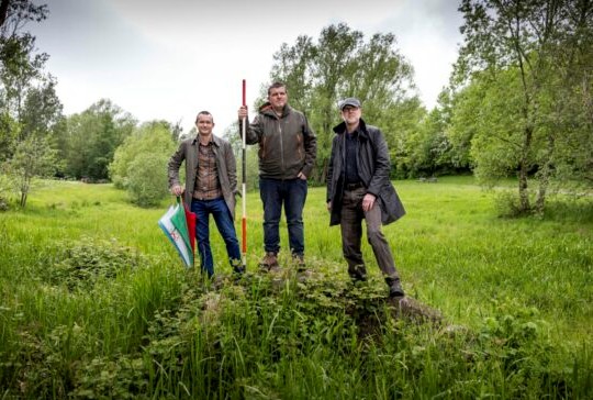
Between 23rd and 28th May 2022, archaeological fieldwork was carried out in Festival Park, Glasgow, the largest green space that survives on the site of the 1988 Festival. This work was carried out by a team from the University of Glasgow Archaeology Department, and funded by Glasgow City Heritage Trust and the University of Glasgow.
The archaeological fieldwork had the following aims:
1. Establish what traces – above and below ground – still remains in Festival Park of the Glasgow Garden Festival
2. Shed light on the processes of construction, use and dismantlement of the Glasgow Garden Festival in this location
3. Gather information that might be used for the future benefit of park users
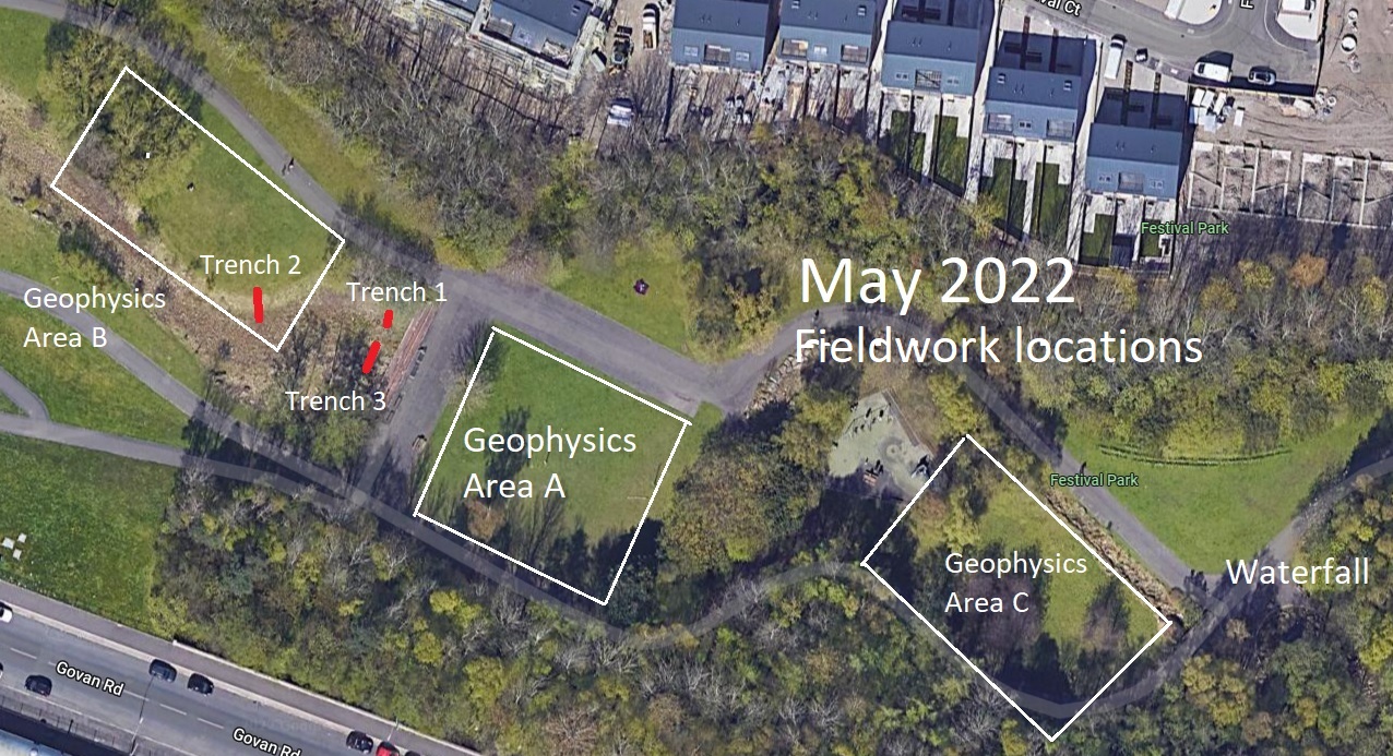
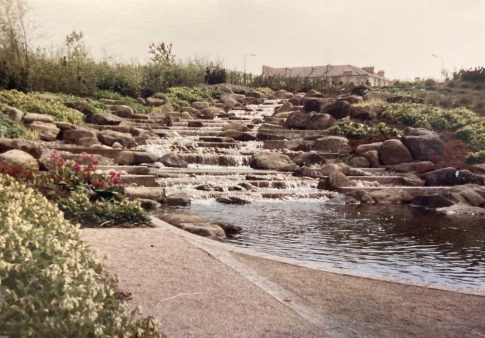
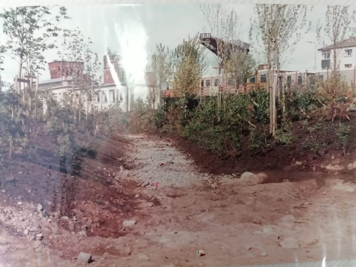
The fieldwork was undertaken where the ‘Landscape and Scenery’ zone of the Glasgow Garden Festival was located. This area had a series of water features running east to west from a well that fed a waterfall, with water then flowing through a stream, lochan and series of underground pipes. Various buildings, artworks, exhibits and the mini-railway line were located here.
Three types of fieldwork were carried out: Plane table survey, Geophysical survey, and Excavation.

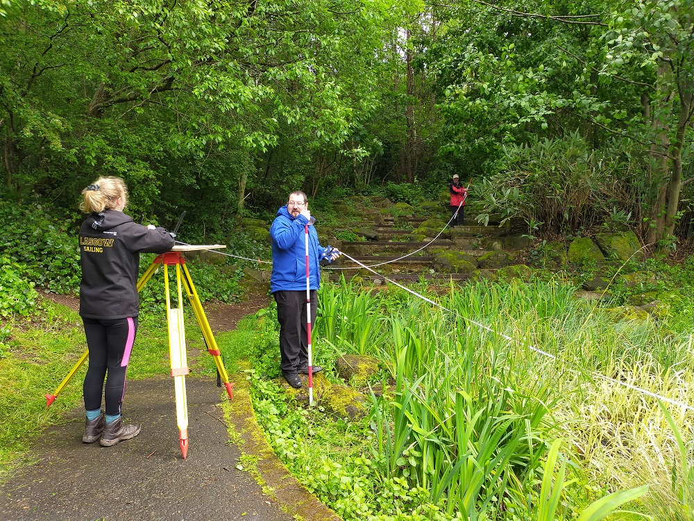
Plane Table survey
A measured survey at 1:50 scale was undertaken of the Waterfall. This is one of the most obvious features still visible of the Festival although it has not operated as a water feature for quite some time. This survey allowed us to spend time on the waterfall structure recording what survives and we can compare this with original photography and architectural drawings. The survey has not yet been fully drawn up but will be added to this website when this work has been completed.

Geophysical survey
Geophysical survey was undertaken in three areas of Festival Park. Magnetometry did not work in the park due to underlying ground conditions, so all survey work was undertaken using a Resistivity Meter. This machine records electrical resistance and can detect buried structures.
Area A was a grid measuring 30m by 30m and in a flat grassy area. The Lochan Restaurant, and the Spirit of the Festival (Bowmore Distillers Pavilion) were both located here. The survey suggests that there are no features here so it seems likely that that these structures were completely removed and their construction did not involve subsurface digging to any great extent.
Area B was on the north side of the lochan, an area where the mini-railway passed through. The survey here, across a grid measuring 40m by 20m, picked up on a linear anomaly roughly on the route of the railway line suggesting that remnants of this feature – perhaps a shallow ditch and some stonework as shown in construction photos – may survive beneath the surface here.
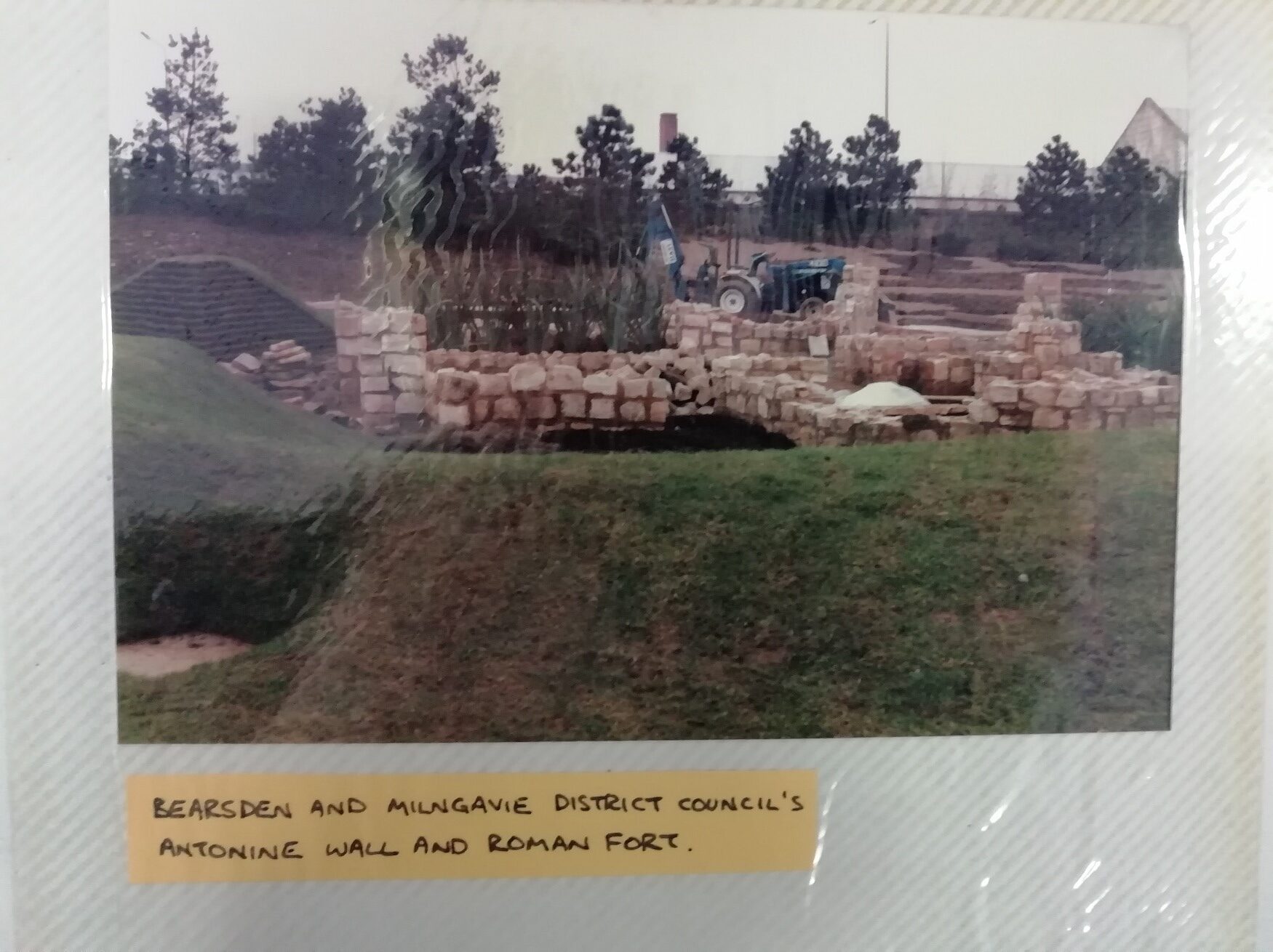
Area C was a grid measuring 40m by 30m and was located in an area that had the Roman bathhouse / Antonine Gardens reconstruction and the edge of the Power of Peat display. Here the survey picked up a very strong anomaly which is more or less where the bathhouse was located, suggesting this stone structure did leave foundations behind or at least a good deal of disturbance related to construction and / or removal. Two linear features of unknown original were also picked up to the south-east of the large anomaly.

Excavation
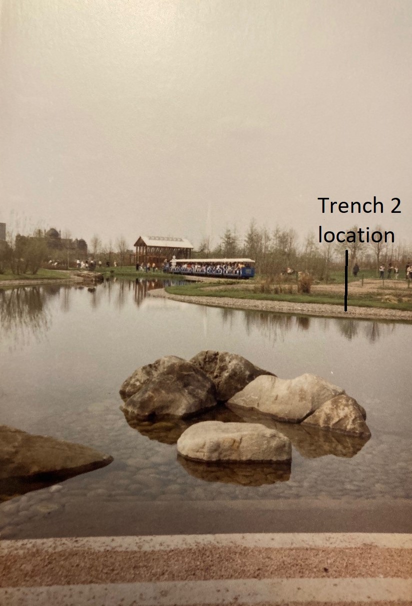
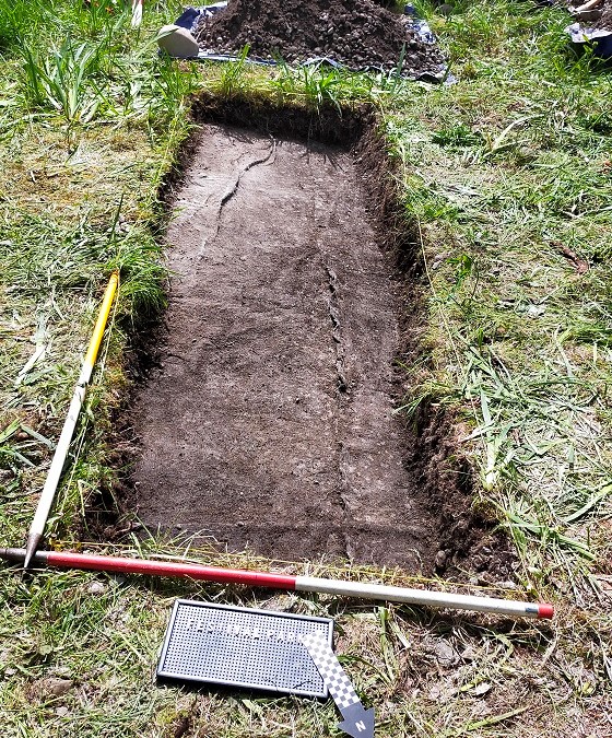
Three small trenches were opened in the former lochan location, one on the north side, the other two towards the centre of this formerly watery feature. We know from construction images that this feature was lined with a membrane at the base, and featured decorative pebbles around the fringes of the water and also at the base of the lochan.

Trench 1 measured 1 x 1m and was located at the eastern end of the lochan near the base of this feature. The single trench fill consisted of angular and rounded pebbles in a dark brown to black loam matrix, which is presumably a combination of material overlying the membrane, and sediment that was more functional than decorative. The membrane was identified at a depth of between 0.16 and 0.2m depth, with the base of the trench sloping south towards the centre of the lochan. Within this trench we recovered, amongst other things, two coins, two nails, a screw, and a small sherd of ceramic. There was little sign of the larger rounded pebbles shown in the water in 1988 photos suggesting these had been removed or dispersed.

Trench 2 was located on the northern side of the lochan, and measured 4m by 1m. This cut across the zone between water and land with a pebble horizon in between. The decorative pebble layer was found towards the lower (south) end of the trench, and was less than 5cm thick, but this seems to have mostly slumped downslope. The membrane was reached in the southern extent of the trench, while in the rest of the trench excavation stopped at a light brown clay silt layer. The membrane was about 0.2m below the current ground surface. Within this trench we recovered, amongst other things, two tile fragments, a metal disc, and fragments of decorative stonework.
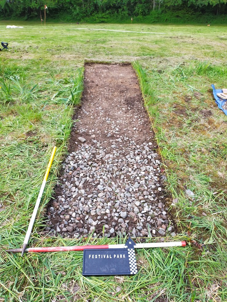
Trench 3 measured 3m by 1m and was located at the eastern end of the lochan at the base of this feature, about 2m west of the steps. This trench had an identical fill to Trench 1, that is, angular and rounded pebbles in a dark brown to black loam matrix. This came down on the membrane at depth of 0.12m on the east side of the trench and 0.2m to the west, with the slope running down towards the centre of the lochan. Within this trench we recovered, amongst other things, four coins, several nails, brick fragments with red paint, and a blue tile that appears to match a tile fragment found in trench 2.
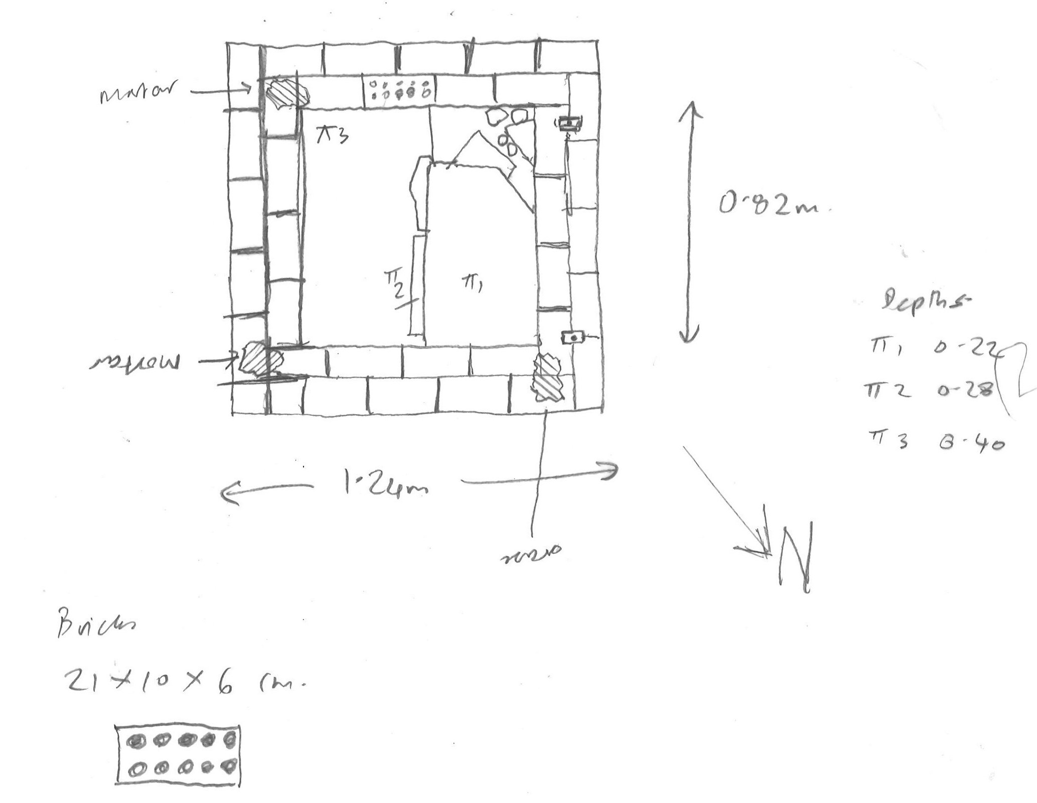
Excavation work was also carried out on the well feature at the top of the waterfall although here we essentially just cleaned this up to get a better understanding of this feature. It was shown to be a square brick structure measuring 1.25m square externally with an internal void of unknown depth 0.8m in plan. Two rusty iron features on one side suggest that some kind of door or cap was once fixed on to this. The interior was filled with slabs, decorative pebbles and rubbish that suggested this had been filled up for safety reasons after the Festival. It was from within this feature that water was pumped into the waterfall.

Discussion of results
The archaeological fieldwork was successful in relation to all of our aims to different extents. Structural and material traces do survive albeit more work needs to be done to understand the implications of this.
Geophysical survey and excavation suggest that most of the Festival features were removed in the wake of the event, including perhaps some of the larger decorative pebbles from the lochan. In some cases structures were surprisingly ephemeral. That the Distillery and Restaurant appear to have left no underground traces suggest that these were built almost wholly above the surface, including services. However on the other hand traces exist of more substantial structures such as the mini-railway and Roman bathhouse foundations. An aspect of the creation of watery places in this area – the two layer membrane – has survived well everywhere we excavated. This is also visible at the surface in areas of the waterfall.
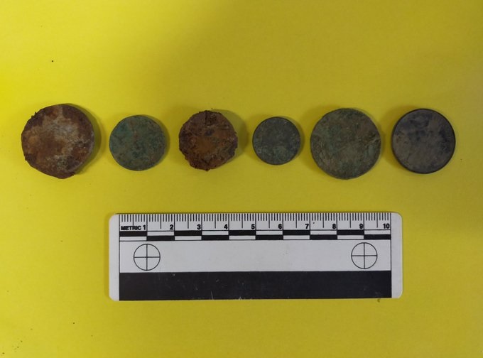
The material culture found in the lochan trenches cannot yet be directly linked to the Glasgow Garden Festival. However finding six coins in such a small area that was underwater until relatively recently suggest it more likely that these were thrown into the water rather than dropped accidentally by six passers-by walking through the park. That these are small denomination (1p, 2p etc) adds to the sense these were thrown into water – but until we can analyse the coins more we cannot be sure when this might have happened. Rusty screws and nails may be remnants of Festival wooden structures post-dismantlement, while blue and white tiles and red-painted brick fragments may also relate to Festival features that could have been lying about during dismantlement and ended up in the water during clearing up. However we cannot rule out some of this material harking back to the pre-Festival levelled post-industrial landscape that was here.
Tangible connections to the Glasgow Garden Festival remain as both visible and invisible components of Festival Park, while further analysis may link material culture more closely to this event. The results of this work will be taken forward in relation to architectural drawings and photographs of Festival site construction, use and destruction, to better understand their significance, and establish the potential for future fieldwork here and in other parts of the Glasgow Garden Festival site.
Thanks
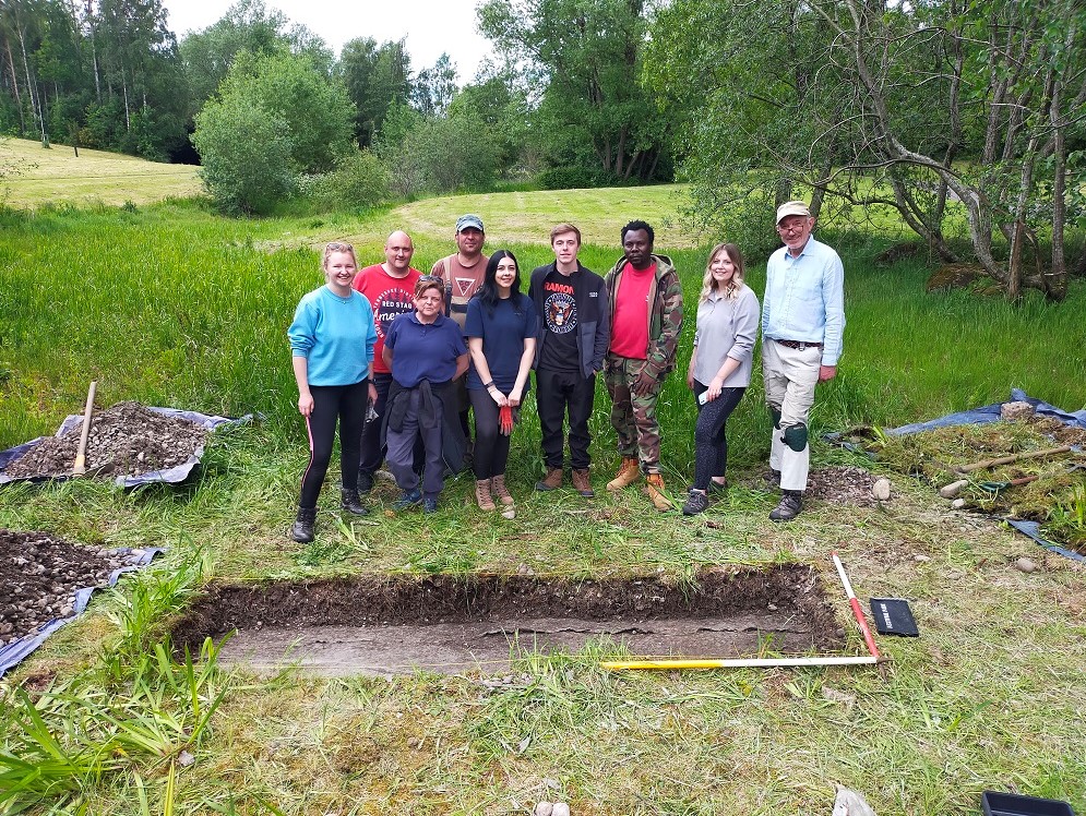
I would like to thank my colleagues Aris Palyvos and Lorraine MacEwan for directing survey aspects of the project. Many thanks to the student team who gave up their time to help out: Ramzy Ali, Rebecca Blunn, Hannah Brown, Luis Delgado, Lynn Freebairn, Billy Jolly, Anne Jones, Stephen Miller, Mary Strickland and Stephen Taylor. Thanks also to Dr Rebecca Younger who carried out research in advance of the fieldwork and for bringing cakes with her when she visited!
Digging the Festival is grant-aided by ![]()
Media coverage:
Observer
BBC News
STV News
Scotsman
Herald
Glasgow Evening Times
Independent
BBC Radio Scotland
Go Radio
Project Scotland
For more information email After the Garden Festival.